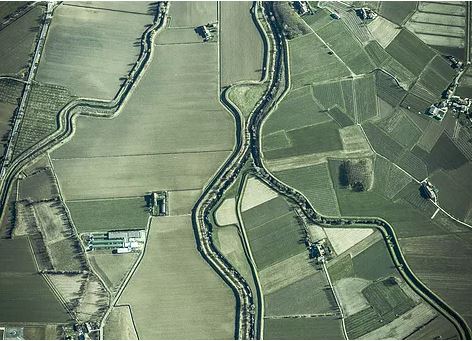
- Through our drone service, the state development authorities can utilize drone data for city planning, Industrial planning, Schools, Colleges, Hospitals, Amusement parks, waste management area, drainage systems and village development.
- Using UAV we can do automated mapping,establishing property boundaries and volumetric calculations.
- Benefits include faster acquisition of data, improved data resolution, risk reduction, access to unreachable locations and cost reduction.
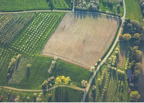
- India is one of the largest producers of Rice, Wheat, Sugarcane, Groundnut, Vegetables, Fruits and Cotton. Through our drone service every state can increase the growth of this sector by precision Agriculture.
- Our Drone Service not only helps to identify the crop health through health algorithms like NDVI and VARI but also the yield at the end of cultivation.
- We can also customize drones for Agriculture Pesticide spraying for crops in a more efficient and effective way so that crops don't get spoiled due to over spraying of pesticide and which in turn also saves a lot of money and ensure good health of people.
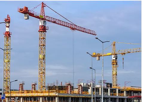
- Our Drones can map and survey different infrastructure projects such as Smart Cities, Roadways, Highways, Railways, Metro, Pipeline etc in a more efficient and effective way.
- It can provide the live status of the project as a 3D map over a timeline. This makes the end users aware of the status of the project for making decisions right from material requirements to the requirements to complete the project in the provided project timeline.
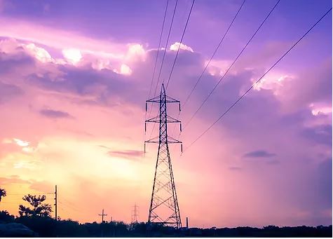
- Manual Inspection through the naked eye is a laborious process because of the height of the power grid lines.
- Our drone inspection makes the inspection easy with a thermal camera payload, it can easily identify the thermal conductivity, crack or corrosion in the power line. Also, it can travel in places like difficult terrains where manual inspection is difficult. Drones can be used for 3D modelling for effective site planning.
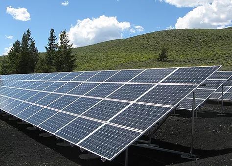
- Solar plant or Solar farm is booming in every state as every state is now focusing on Green Energy generation.
- Since these solar farms are installed to generate hundreds of Megawatts and can occupy a space of thousands of acres of land. Inspection of these solar plant over a time period is mandatory as to check whether the plant is running in full efficiency or any fault has occurred in some panels.
- Manual inspection becomes a tedious and time consuming task. Our drones can fly over these panels and can identify the faulty panels within minutes through the thermal imaging camera which can help timely rectification of problem.
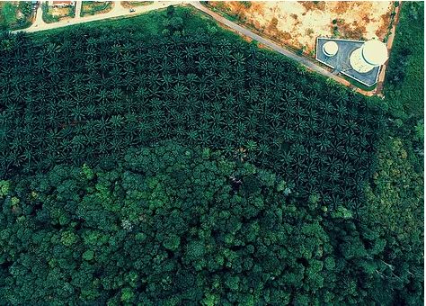
- Our drone service will help in better monitoring of wildlife situations (both flora and fauna).
- Using drones the exact location of poachers can be identified , endangered species can be protected and deforestation can be avoided.
- The data captured can be also be used to study the behavior of animals and can track animal movements.