We are an authorized technical training partner for Bentley ContextCapture all over India.
- Understanding Land Surveying using Drones
- Pre-site visit to create flight plan for collecting remote sensing drone data
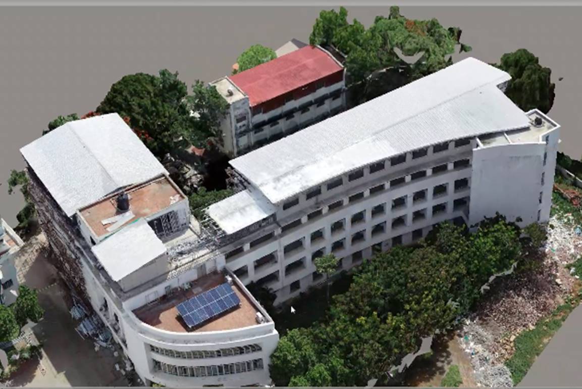
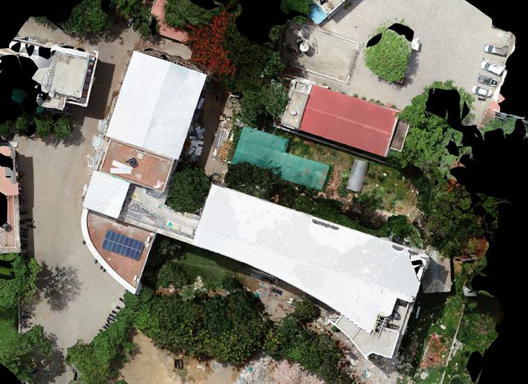
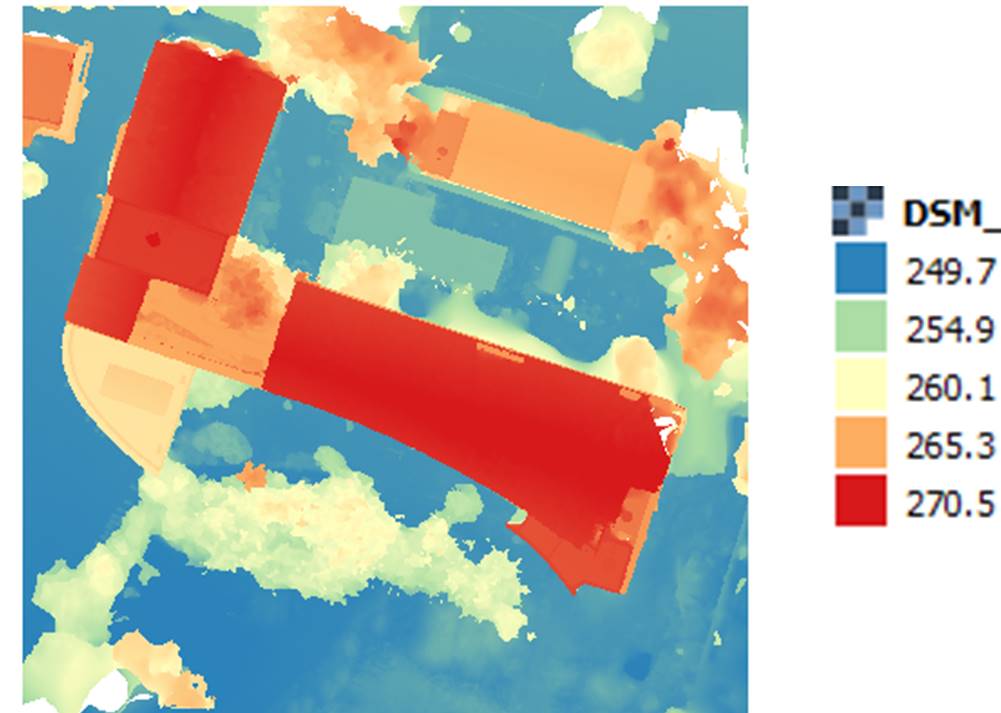
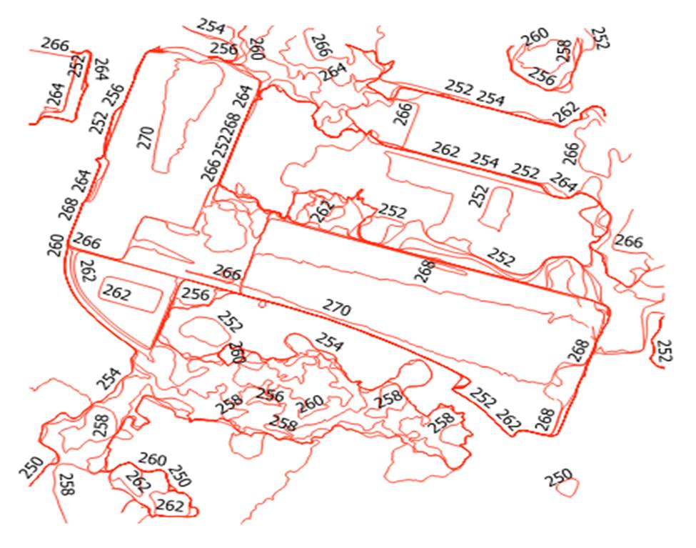
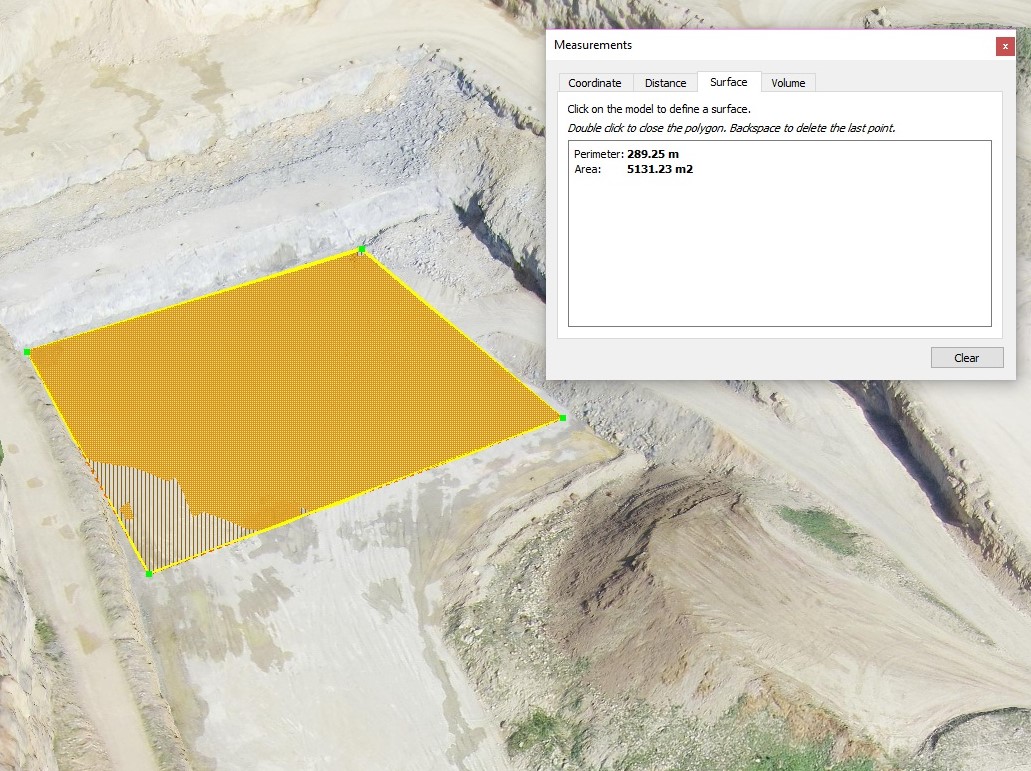
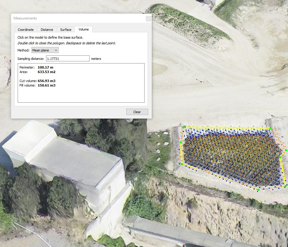
- Post processing to generate survey results such as 3D model, orthomosaic, DSM, contours
Outcomes of the Workshop:
- A very unique program to get trained on Drone remote sensing application according to the industry requirements
- A complete Flight plan manual and post processing guide
- Dual certificate program – Bentley OEM certificate and Aviocian Technologies certificate with unique ID.
- Bridging the skill gap between academia and Industry
- Students becoming Job Ready
Benefits of the workshop:
TRAINING FOR:
- Students (Civil and Infrastructure Engineering, Urban Planning and Architecture, Remote Sensing, Geo-Informatics)
- Corporate
- Government Departments

Drone Surveying and Mapping using Bentley ContextCapture
Specially Designed for Civil Engineering, Urban Planning and Remote Sensing
Drone Industrial training on Surveying and Mapping
DUAL Certification Training program specially designed for all branches of engineering to make students Industry/Job Ready